Sunday, August 4, 2013

Hawaii County GIS Resources - Address Data


I'm spending this week on Big Island working with county staff who use GIS in their work.  I've compiled some links to online resources that we'll be using during the week and since they may have broader interest, I'm sharing them here.

In a post on general resources, I provided information and links on:
  - Upcoming Events
  - ArcGIS for Desktop: Data Driven Pages
  - ArcGIS for Desktop: Editing
  - ArcGIS for Desktop: Miscellaneous
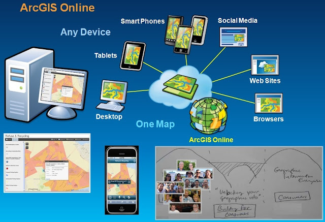
  - ArcGIS Online
  - LGIM: Local Government Information Models

In an another post I provide information and links on parcel (TMK) data.

In this post I'll cover another fundamental GIS layer in local government - the address layer.

ADDRESSES

Addresses...

http://video.esri.com/watch/1869/arcgis-for-local-government-address-maps-and-apps

http://video.esri.com/watch/2048/departmental-collaboration


Hawaii County GIS Resources - Parcel (TMK) Data


I'm spending this week on Big Island working with county staff who use GIS in their work.  I've compiled some links to online resources that we'll be using during the week and since they may have broader interest, I'm sharing them here.

In a post on general resources, I provided information and links on:
  - Upcoming Events
  - ArcGIS for Desktop: Data Driven Pages
  - ArcGIS for Desktop: Editing
  - ArcGIS for Desktop: Miscellaneous
  - ArcGIS Online
  - LGIM: Local Government Information Models

In an another post I provide information and links on address data.

In this post I'll cover one of the fundamental GIS layers in local government - the parcel layer.

COUNTY REAL PROPERTY MAPS AND INFORMATION (TMK DATA)

The County of Hawaii Real Property Tax Division maintains maps and data describing land parcels in the County. This is often called the TMK (Tax Map Key) data after the unique tax map key number assigned to every property. Each TMK has nine digits (ie: 322012004) assigned as 'dzspppnnn' where:

   d = the Division: Hawaii County is always 3
   z = the Zone: Hawaii County has nine zones (see map to the left)
   s = the Section: each zone is divided into nine sections
   ppp = the Plat: each section is divided into plats
   nnn = the Parcel number within a plat

Division, Zone, Section, Plat (three digits) and Parcel (three digits) are combined to create a unique TMK number for every parcel in the County. In my example, 322012004, the division is 3, the zone is 2, the section is 2, the plat is 12 and the parcel is 4. Note the use of leading zeros for the plat and parcel numbers.

Some parcels have taxable units within the parcel. Sometimes these are condos, sometimes agricultural lots, sometimes for other reasons. These CPR or HPR numbers, if they exist, add four more digits on to the right side of the TMK, creating a thirteen digit full TMK. There are none for the example parcel, so its full TMK is 3220120040000.

Real Property Links

Here are some useful links to find Hawaii County Real Property maps and information:

Searchable data: Ownership, sales, permit and other information can be searched for by TMK or by Address at:
http://www.hawaiipropertytax.com/Main/Home.aspx

Plat maps: Parcel maps are organized by plats, there is a separate map sheet (plat map) for every plat in the County. Each plat map sheet has been scanned and is available online. Here's the link:
http://www.hawaiicounty.gov/real-property-tmk-maps/

Subdivision maps: Plat map sheets compile information from one or more subdivision maps. The individual subdivision maps are also available online. Here's the link:
http://www.hawaiicounty.gov/subdivision-maps/

A few notes:

- The Division is the same for the entire County (3) and it is left off of the TMK in some databases, leaving an eight digit TMK. While this works within a single county, it does not work for statewide TMK databases.

- In some databases, the TMK is written with dashes and a colon to make it easier for people to read, and often the Division is dropped, so you'll see 'z-s-ppp:nnn' for the TMK.  This can wreak havoc when relating different tables by TMK, be careful!

For more examples of how TMK data can be used in GIS, you can read my Hawaii GeoTeam 2013 blog on TMK data in GIS.

LGIM FOR LAND RECORDS

There are maps and apps that work with the LGIM for Land Records.  

Hawaii County GIS Resources - General


I'm spending this week on Big Island working with county staff who use GIS in their work.  I've compiled some links to online resources that we'll be using during the week and since they may have broader interest, I'm sharing general information here.

In other posts I provide specific information and links on:
  - Parcel (TMK) Data
  - Address Data

UPCOMING EVENTS

First, a few upcoming events including a couple of online classes:

Aug 20-22, 2013   Online Class: ArcGIS for Server: Site Configuration and Administration (10.1)
Aug 27-29, 2013   Online Class: Configuring and Managing the Multiuser Geodatabase (10.1)
Sep 18-20, 2013   Conference: HCPO Hawaii Congress of Planning Officials (Kailua-Kona, Hawaii)


ARCGIS FOR DESKTOP: DATA DRIVEN PAGES (MAP BOOKS)

There used to be an extension in ArcGIS for Desktop called "DS Mapbook". It was a great little extension that provided tools to help you create a map book. At ArcGIS 10.0 (and 10.1 and 10.2) similar tools are part of the core product on the Data Driven Pages toolbar.

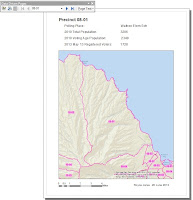
I posted on the Hawaii GeoTeam 2013 blog about election data including an introduction to Data Driven Pages.  Here's the link:
http://geoteam2013.blogspot.com/2013/06/show-tell-for-module-8-election-data.html

There's a 70 minute video from Esri UC 2013 demonstrating how to use Data Driven Pages and how to customize map books using Python scripts.  Here's the link:
http://video.esri.com/watch/2598/building-map-books-in-arcgis


ARCGIS FOR DESKTOP: EDITING

There are a couple of really good videos from Esri UC 2012 that cover editing.  Each lasts more than an hour and shows lots of useful examples.
ArcGIS for Desktop Editing (An Introduction)   (Technical Workshop Video)
ArcGIS for Desktop Editing (Tips and Tricks)   (Technical Workshop Video)


ARCGIS FOR DESKTOP: MISCELLANEOUS

You can purchase a Home Use license of ArcGIS for Desktop that you can use for non-commercial, personal purposes. You can find the details here:


EXAMPLES OF EMBEDDED WEB MAPS

South Dakota Game, Fish and Parks
Kansas City Public Works
Southern California Silver Fire

Hawaii County Beach Parks - embedded web map

Click on a park for more information on that park.

Use the Hawaii County Beach Park Finder App to search for beach parks by activity or facilities available.

LGIM: LOCAL GOVERNMENT INFORMATION MODELS


LGIM - Local Government Information Model Maps and Apps 
LGIM Maps and Apps for Land Records 
LGIM Maps and Apps for Water Utilities 
LGIM Maps and Apps for Public Safety